From Wikipedia, the free encyclopedia
Bangladesh became one of the large nation states in 1971 when it seceded from
Pakistan. Prior to the creation of Pakistan in 1947, modern-day Bangladesh was part of
ancient,
classical,
medieval and
colonial India. Since independence, the government has experienced periods of democratic and military rule. The father of the country and its first president was
Sheikh Mujibur Rahman. His daughter
Sheikh Hasina Wazed is currently the prime minister, as leader of the
Awami League. The opposition
Bangladesh Nationalist Party is led by
Begum Khaleda Zia, who is the widow of the revered freedom fighter and former military ruler
Ziaur Rahman.
[edit] Etymology of Bengal
The exact origin of the word
Bangla or Bengal is unknown, though it is believed to be derived from the Dravidian-speaking tribe
Bang/Banga that settled in the area around the year 1000 BCE.
[1][2] Other accounts speculate that the name is derived from
Vanga (
bôngo), which came from the
Austric word "Bonga" meaning the Sun-god. According to
Mahabharata,
Purana,
Harivamsha Vanga was one of the adopted sons of king
Vali who founded the Vanga kingdom. The Muslim Accounts refer that "Bong", a son of Hind (son of Hām who was a son of Prophet
Noah/Nooh) colonized the area for the first time.
[3] The earliest reference to "Vangala" (
Bôngal) has been traced in the Nesari plates (805 AD) of
Rashtrakuta Govinda III which speak of
Dharmapala as the king of Vangala. Shams-ud-din
Ilyas Shah took the title "Shah-e-Bangalah" and united the whole region under one government for the first time.
[4]
[edit] Ancient period
[edit] Pre-historic Bengal
Stone tools provide the earliest evidence of human settlements. Prehistoric stone implements have been discovered in various parts of West Bengal in the districts of Midnapur, Bankura and Burdwan. But it is difficult to determine, even approximately, the time when people using them first settled in Bengal. It might have taken place ten thousand years (or even more) ago. The original settlers spoke non-
Aryan languages—they may have spoken
Austric or
Austro-Asiatic languages like the languages of the present-day Kola,
Bhil,
Santal, Shabara and Pulinda peoples. At a subsequent age, peoples speaking languages from two other language families—
Dravidian and
Tibeto-Burman—seem to have settled in Bengal. Archaeological discoveries during the 1960s furnished evidence of a degree of civilisation in certain parts of Bengal as far back as the beginning of the
first millennium BC, perhaps even earlier. The discoveries at
Pandu Rajar Dhibi in the valley of the
Ajay River (near
Bolpur) in
Burdwan district and in several other sites on the Ajay, Kunar and
Kopai Rivers have thrown fresh light on Bengal's prehistory.
Pandu Rajar Dhibi represents the ruins of a trading township, which carried on trade not only with the interior regions of India, but also—possibly indirectly—with the countries of the
Mediterranean.
[edit] Bengal in mythology
Some deprecatory references indicate that the early people in Bengal were different in ethnicity and culture from the Vedic beyond the boundary of Aryandom and who were classed as '
Dasyus'. The Bhagavata Purana classes them as sinful people while Dharmasutra of Bodhayana prescribes expiatory rites after a journey among the Pundras and Vangas.
Mahabharata speaks of
Paundraka Vasudeva who was lord of the Pundrasand who allied himself with Jarasandha against Krishna. Mahabharata also speaks of Bengali kings called Chitrasena and Sanudrasena who were defeated by Bhima, Kalidas mentions Raghu defeated a coalition of Vanga kings who were defeated by Raghu and Raghu established a victory column in the Gangetic delta.
[edit] Proto-History
Hindu scriptures such as the
Mahabharata say that Bangladesh was divided among various tribes or kingdoms, including the
Nishadas and kingdoms known as the Janapadas:
Vanga (southern Bengal),
Pundra (northern Bengal), and
Suhma (western Bengal) according to their respective totems. These Hindu sources, written by
Indo-Aryans in what is now Punjab and Uttar Pradesh, say that the peoples of Bangladesh were not Indo-Aryans. However,
Jain scriptures identify Vanga and
Anga in Bangladesh as Indo-Aryan. While western Bangladesh, as part of
Magadha, became part of the Indo-Aryan civilization by the 7th century BCE, the
Nanda Dynasty was the first historical state to unify all of Bangladesh under Indo-Aryan rule.
[edit] Overseas Colonization
The
Vanga Kingdom was a powerful seafaring nation of
Ancient India. They had overseas trade relations with
Java,
Sumatra and
Siam (modern day
Thailand). According to
Mahavamsa, the
Vanga prince
Vijaya Singha conquered
Lanka (modern day
Sri Lanka) in 544 BC and gave the name "
Sinhala" to the country.
Bengali people migrated to the
Maritime Southeast Asia and
Siam (in modern Thailand), establishing their own colonies there.
[4]
[edit] Gangaridai Empire
Though north and west Bengal were part of the Magadhan empire southern Bengal thrived and became powerful with her overseas trades. In 326 BCE, with the invasion of
Alexander the Great the region again came to prominence. The Greek and Latin historians suggested that Alexander the Great withdrew from India anticipating the valiant counter attack of the mighty
Gangaridai empire that was located in the Bengal region. Alexander, after the meeting with his officer,
Coenus, was convinced that it was better to return.
Diodorus Siculus mentions Gangaridai to be the most powerful empire in India whose king possessed an army of 20,000 horses, 200,000 infantry, 2,000 chariots and 4,000 elephants trained and equipped for war. The allied forces of
Gangaridai Empire and
Nanda Empire (Prasii) were preparing a massive counter attack against the forces of Alexander on the banks of Ganges. Gangaridai according to the Greek accounts kept on flourishing at least up to the 1st century AD.
[edit] Early Middle Ages
The pre-Gupta period of Bengal is shrouded with obscurity. Before the conquest of
Samudragupta Bengal was divided into two kingdoms: Pushkarana and Samatata.
Chandragupta II had defeated a confederacy of
Vanga kings resulting in Bengal becoming part of the Gupta Empire.
[edit] Gauda Kingdom
By the sixth century, the Gupta Empire ruling over the northern Indian subcontinent was largely broken up.
Eastern Bengal became the
Vanga Kingdom while the
Gauda kings rose in the west with their capital at Karnasuvarna (
Murshidabad).
Shashanka, a vassal of the last Gupta Empire became independent and unified the smaller principalities of Bengal (Gaur, Vanga, Samatata) and vied for regional power with
Harshavardhana in northern India. But this burst of Bengali power did not last beyond his death, as Bengal descended afterwards into a period marked by disunity and foreign invasion.
[edit] The Pala dynasty
Main article:
Pala Empire were the first independent
Buddhist dynasty of Bengal. The name
Pala (
Modern Bengali:
পাল pal) means
protector and was used as an ending to the names of all Pala monarchs. The Palas were followers of the
Mahayana and
Tantric schools of Buddhism.
Gopala was the first ruler from the dynasty. He came to power in 750 in
Gaur by a
democratic election. This event is recognized as one of the first
democratic elections in
South Asia since the time of the
Mahā Janapadas. He reigned from 750-770 and consolidated his position by extending his control over all of
Bengal. The
Buddhist dynasty lasted for four centuries (750-1120 AD) and ushered in a period of stability and prosperity in
Bengal. They created many temples and works of art as well as supported the Universities of
Nalanda and
Vikramashila.
Somapura Mahavihara built by
Dharmapala is the greatest
Buddhist Vihara in the
Indian Subcontinent.
The empire reached its peak under
Dharmapala and
Devapala. Dharmapala extended the empire into the northern parts of the
Indian Subcontinent. This triggered once more for the control of the subcontinent.
Devapala, successor of Dharmapala, expanded the empire to cover much of
South Asia and beyond. His empire stretched from
Assam and
Utkala in the east,
Kamboja (modern day
Afghanistan) in the north-west and
Deccan in the south. According to Pala copperplate inscription Devapala exterminated the Utkalas, conquered the Pragjyotisha (Assam), shattered the pride of the
Huna, and humbled the lords of
Gurjara,
Pratiharas and the
Dravidas.
The death of Devapala ended the period of ascendancy of the Pala Empire and several independent dynasties and kingdoms emerged during this time. However,
Mahipala I rejuvenated the reign of the Palas. He recovered control over all of Bengal and expanded the empire. He survived the invasions of
Rajendra Chola and the
Chalukyas. After Mahipala I the Pala dynasty again saw its decline until
Ramapala, the last great ruler of the dynasty, managed to retrieve the position of the dynasty to some extent. He crushed the
Varendra rebellion and extended his empire farther to
Kamarupa, Orissa and Northern India.
The Pala Empire can be considered as the golden era of Bengal. Never had the Bengali people reached such height of power and glory to that extent. Palas were responsible for the introduction of
Mahayana Buddhism in
Tibet,
Bhutan and
Myanmar. The Pala had extensive trade as well as influence in
south-east Asia. This can be seen in the sculptures and architectural style of the
Sailendra Empire (present-day
Malaya,
Java,
Sumatra).
[edit] Sena dynasty
Main article:
Sena EmpireThe Palas were followed by the
Sena dynasty who brought
Bengal under one ruler during the twelfth century.
Vijay Sen the second ruler of this dynasty defeated the last
Pala emperor Madanapala and established his reign.
Ballal Sena introduced
caste system in Bengal and made
Nabadwip the capital. The fourth king of this dynasty
Lakshman Sen expanded the empire beyond Bengal to
Bihar,
Assam, and
Orissa. Lakshman was later defeated by the
Muslims and fled to eastern Bengal were he ruled few more years. The Sena dynasty brought a revival of
Hinduism and cultivated
Sanskrit literature in
India. It is believed by some Bengali authors that
Jayadeva, the famous Sanskrit poet and author of
Gita Govinda, was one of the
Pancharatnas (meaning 5 gems) in the court of Lakshman Sen.
[edit] Late Middle Ages - arrival of Islam
Islam made its first appearance in Bengal during the twelfth century AD when
Sufi missionaries arrived. Later occasional Muslim invaders reinforced the process of conversion by building
mosques,
madrassas and Sufi
Khanqah. Beginning in 1202 a military commander from the
Delhi Sultanate,
Bakhtiar Khilji, overran
Bihar and Bengal as far east as
Rangpur,
Bogra and the
Brahmaputra River. The defeated Laksman Sen and his two sons moved to a place then called
Vikramapur (present-day
Munshiganj District), where their diminished dominion lasted until the late thirteenth century.
[edit] Turkic rule
[edit] Khilji maliks
The period after Bakhtiar Khilji's death in 1206 devolved into infighting among the Khiljis - representative of a pattern of succession struggles and intra-empire intrigues during later Turkic regimes. Ghiyasuddin Iwaz Khalji prevailed and extended the Sultan's domain south to
Jessore and made the eastern Bang province a tributary. The capital was made at
Lakhnauti on the Ganges near the older Bengal capital of
Gaur. He managed to make
Kamarupa,
Orissa and Trihut pay tribute to him. But he was later defeated by Shams-ud-Din
Iltutmish.
[edit] Mameluk rule
The weak successors of Iltutmish encouraged the local governors to declare independence. Bengal was sufficiently remote from Delhi that its governors would declare independence on occasion, styling themselves as Sultans of Bengal. It was during this time that Bengal earned the name "Bulgakpur" (land of the rebels). Tughral Togun Khan added
Oudh and
Bihar to Bengal. Mughisuddin Yuzbak also conquered Bihar and Oudh from Delhi but was killed during an unsuccessful expedition in Assam. Two Turkic attempts to push east of the broad
Jamuna and Brahmaputra rivers were repulsed, but a third led by
Mughisuddin Tughral conquered the
Sonargaon area south of Dhaka to
Faridpur, bringing the Sen Kingdom officially to an end by 1277. Mughisuddin Tughral repulsed two massive attacks of the sultanate of Delhi before finally being defeated and killed by
Ghiyas ud din Balban.
[edit] Mahmud Shahi dynasty
Mahmud Shahi dynasty started when Nasiruddin Bughra Khan declared independence in Bengal. Thus Bengal regained her independence back. Nasiruddin Bughra Khan and his successors ruled Bengal for 23 years finally being incorporated into Delhi Sultanate by Ghyiasuddin Tughlaq.
[edit] Ilyas Shahi dynasty
Shamsuddin Iliyas Shah founded an independent dynasty that lasted from 1342-1487. The dynasty successfully repulsed attempts by Delhi to conquer them. They continued to reel in the territory of modern-day Bengal, reaching to
Khulna in the south and
Sylhet in the east. The sultans advanced civic institutions and became more responsive and "native" in their outlook and cut loose from Delhi. Considerable architectural projects were completed including the massive
Adina Mosque and the Darasbari Mosque which still stands in Bangladesh near the border. The Sultans of
Bengal were patrons of
Bengali literature and began a process in which Bengali culture and identity would flourish. The Ilyas Shahi Dynasty was interrupted by an uprising by the Hindus under
Raja Ganesha. However the Ilyas Shahi dynasty was restored by
Nasiruddin Mahmud Shah. The dynasty was finally overthrown by the
Habshi (
Abyssinian) slaves of the sultanate.
[edit] Hussain Shahi dynasty
The Habshi rule gave way to the
Hussain Shahi dynasty that ruled from 1494-1538.
Alauddin Hussain Shah, considered as the greatest of all the sultans of Bengal for bringing cultural renaissance during his reign. He conquered Kamarupa, Kamata, Jajnagar, Orissa and extended the sultanate all the way to the port of
Chittagong, which witnessed the arrival of the first Portuguese merchants.
Nasiruddin Nasrat Shah gave refuge to the Afghan lords during the invasion of
Babur though he remained neutral. However Nusrat Shah made a treaty with Babur and saved Bengal from a Mughal invasion. The last Sultan of the dynasty, who continued to rule from
Gaur, had to contend with rising Afghan activity on his northwestern border. Eventually, the Afghans broke through and sacked the capital in 1538 where they remained for several decades until the arrival of the Mughals.
[edit] Pashtun rule
[edit] Suri dynasty
Sher Shah Suri established the
Sur dynasty in Bengal. After the battle of Chausa he declared himself independent Sultan of Bengal and Bihar. Sher Shah was the only Muslim Sultan of Bengal to establish an empire in northern India. The
Delhi Sultanate Islam Shah appointed Muhammad Khan Sur as the governor of Bengal. After the death of Islam Shah, Muhammad Khan Sur became independent. Muhammad Khan Sur was followed by Ghyiasuddin Bahadur Shah and Ghyiasuddin Jalal Shah. The Pashtun rule in Bengal remained for 44 years. Their most impressive achievement was Sher Shah's construction of the
Grand Trunk Road connecting
Sonargaon,
Delhi and
Peshawar.
[edit] Karrani dynasty
The Sur dynasty was followed by the Karrani dynasty.
Sulaiman Khan Karrani annexed Orissa to the Muslim sultanate permanently.
Daoud Shah Karrani declared independence from Akbar which led to four years of bloody war between the Mughals and the Pashtuns. The Mughal onslaught against the Pashtun Sultan ended with the battle of
Rajmahal in 1576, led by Khan Jahan. However, the Pashtun and the local landlords (
Baro Bhuyans) led by
Isa Khan resisted the Mughal invasion.
[edit] Mughal period
Bengal came once more under the control of Delhi as the
Mughals conquered it in 1576. At that time
Dhaka became a Mughal provincial capital. But it remained remote and thus a difficult to govern the region especially the section east of the
Brahmaputra River remained outside the mainstream of Mughal politics. The Bengali ethnic and linguistic identity further crystallized during this period, since the whole of Bengal was united under an able and long-lasting administration. Furthermore its inhabitants were given sufficient autonomy to cultivate their own customs and literature.
In 1612, during Emperor
Jahangir's reign, the defeat of Sylhet completed the Mughal conquest of Bengal with the exception of
Chittagong. At this time Dhaka rose in prominence by becoming the provincial capital of Bengal. Chittagong was later annexed in order to stifle Arakanese raids from the east. A well-known Dhaka landmark,
Lalbagh Fort, was built during Aurangzeb's sovereignty.
History repeated itself as the frontier Bengal province broke off from a Delhi-based empire around the time Aurangzeb's death in 1707.
Murshid Quli Khan ended Dhaka's century of grandeur as he shifted the capital to
Murshidabad ushering in a series of independent Bengal
Nawabs. Nawab
Alivardi Khan showed military skill during his wars with the
Marathas. He completely routed the Marathas from Bengal. He crushed an uprising of the Afghans in Bihar and made the British pay 150,000 Tk for blocking Mughal and Armenian trade ships.
[edit] Europeans in Bengal
Portuguese traders and missionaries were the first Europeans to reach
Bengal in the latter part of the fifteenth century. They were followed by representatives from the
Netherlands,
France, and the
British East India Company. The Mughal
Subahdar of Bengal Kasim Khan Mashadi completely destroyed the Portuguese forces in the
Battle of Hoogly (1632). About 10,000 Portuguese men and women died in the battle and 4,400 were sent captive to Delhi.
During
Aurangzeb's reign, the local Nawab sold three villages, including one then known as
Calcutta, to the British. Calcutta was Britain's first foothold in Bengal and remained a focal point of their economic activity. The British gradually extended their commercial contacts and administrative control beyond Calcutta to the rest of Bengal.
Job Charnock was one of the first dreamers of a British empire in Bengal. He waged war against the Mughal authority of Bengal which led to the Anglo-Mughal war for Bengal (1686–1690).
Shaista Khan, the
Nawab of Bengal, defeated the British in the battles of
Hoogly as well as
Baleshwar and expelled the British from Bengal. Captain
William Heath with a naval fleet moved towards
Chittagong but it was a failure and he had to retreat to
Madras.
[edit] British rule
The British East India Company gained official control of Bengal following the
Battle of Plassey in 1757. This was the first conquest, in a series of engagements that ultimately lead to the expulsion of other European competitors. The defeat of the Mughals and the consolidation of the subcontinent under the rule of a corporation was a unique event in imperialistic history.
Kolkata (Anglicized as "Calcutta") on the Hooghly became a major trading port for
bamboo,
tea,
sugar cane,
spices,
cotton,
muslin and
jute produced in
Dhaka,
Rajshahi,
Khulna, and
Kushtia.
Scandals and the bloody rebellion known as the
Sepoy Mutiny prompted the British government to intervene in the affairs of the
East India Company. In 1858, authority in India was transferred from the Company to the crown, and the rebellion was brutally suppressed. Rule of India was organized under a
Viceroy and continued a pattern of economic exploitation. Famine racked the subcontinent many times, including at least two major famines in Bengal. The
British Raj was politically organized into seventeen provinces of which Bengal was one of the most significant. For a brief period in the early twentieth century, an abortive attempt was made to
divide Bengal into two zones, West Bengal and East Bengal & Assam.
[edit] Bengal Renaissance
The
Bengal Renaissance refers to a social reform movement during the nineteenth and early twentieth centuries in Bengal during the period of
British rule. The
Bengal renaissance can be said to have started with
Raja Ram Mohan Roy (1775–1833)
[5] and ended with
Rabindranath Tagore (1861–1941). Nineteenth century Bengal was a unique blend of religious and social reformers, scholars, literary giants, journalists, patriotic orators and scientists, all merging to form the image of a renaissance, and marked the transition from the 'medieval' to the 'modern'
[6].
[edit] Creation of Pakistan
Main article:
East PakistanAs the independence movement throughout British-controlled India began in the late nineteenth century gained momentum during the twentieth century, Bengali politicians played an active role in
Mohandas Gandhi's
Congress Party and
Mohammad Ali Jinnah's
Muslim League, exposing the opposing forces of ethnic and
religious nationalism. By exploiting the latter, the British probably intended to distract the independence movement, for example by partitioning Bengal in 1905 along religious lines. The split only lasted for seven years.
At first the Muslim League sought only to ensure minority rights in the future nation. In 1940 the Muslim League passed the
Lahore Resolution which envisaged one or more Muslim majority states in South Asia. Non-negotiable was the inclusion of the Muslim parts of Punjab and Bengal in these proposed states. The stakes grew as a new Viceroy
Lord Mountbatten of Burma was appointed expressly for the purpose of effecting a graceful British exit. Communal violence in
Noakhali and
Calcutta sparked a surge in support for the Muslim League, which won a majority of Bengal's Muslim seats in the 1946 election. Accusations have been made that Hindu and Muslim nationalist instigators were involved in the latter incident. At the last moment
Huseyn Shaheed Suhrawardy and
Sarat Chandra Bose came up with the idea of an independent and unified Bengal state, which was endorsed by Jinnah. This idea was vetoed by the
Indian National Congress.
British India was partitioned and the independent states of
India and
Pakistan were created in 1947; the region of Bengal was divided along religious lines. The predominantly Muslim eastern half of Bengal became the
East Bengal (later renamed
East Pakistan) state of Pakistan and the predominantly Hindu western part became the Indian state of
West Bengal.
Pakistan's history from 1947 to 1971 was marked by political instability and economic difficulties. In 1956 a constitution was at last adopted, making the country an "Islamic republic within the Commonwealth". The nascent democratic institutions foundered in the face of military intervention in 1958, and the government imposed martial law between 1958 and 1962, and again between 1969 and 1971.
Almost from the advent of independent Pakistan in 1947, frictions developed between East and West Pakistan, which were separated by more than 1,000 miles of Indian territory. East Pakistanis felt exploited by the West Pakistan-dominated central government. Linguistic, cultural, and ethnic differences also contributed to the estrangement of East from West Pakistan.
When
Mohammad Ali Jinnah died in September 1948,
Khwaja Nazimuddin became the Governor General of Pakistan while
Nurul Amin was appointed the Chief Minister of East Bengal. Nurul Amin continued as the Chief Minister of East Bengal until 2 April 1954. The abolition of the
Zamindari system in East Bengal (1950) and the
Language Movement were two most important events during his tenure.
[edit] The Bengali Language Movement
The question as to what would be the state language of Pakistan was raised immediately after its creation. The central leaders and the
Urdu-speaking intellectuals of Pakistan declared that Urdu would be the state language of Pakistan, just as Hindi was the state language of India. However, Bengalis strongly resisted attempts to impose Urdu as the sole official language of Pakistan, and the students and intellectuals of East Pakistan, demanded that
Bengali (Bangla) be made one of the state languages, arguing that it was in any case the native language of the majority (54% native speakers as opposed to 7% native Urdu speakers) in the whole of Pakistan.
The
Bengali Language Movement began in 1948 and reached its climax in a demonstration on 21 February 1952 at which several demonstrators were killed by police. After a lot of controversy over the language issue, the final demand from East Pakistan was that Bangla must be the official language and the medium of instruction in East Pakistan, and that for the central government it would be one of the state languages along with Urdu. The first movement on this issue was mobilised by
Tamaddun Majlish headed by Professor
Abul Kashem. Gradually many other non-communal and progressive organisations joined the movement, which finally turned into a mass movement, and ended in the adoption of Bengali as one of the state languages of Pakistan.
[edit] Politics: 1954 - 1970
The first election for East Bengal Provincial Assembly was held between 8 March and 12 March 1954. The
Awami Muslim League,
Krishak-Sramik Party and
Nezam-e-Islam formed the
United Front, on the basis of 21-points agenda.
Notable pledges contained in the 21-points were:
- making Bengali one of the main state languages
- autonomy for the province
- reforms in education
- independence of the judiciary
- making the legislative assembly effective
The United Front won 215 out of 237 Muslim seats in the election. The ruling Muslim League got only nine seats.
Khilafat-E-Rabbani Party got one, while the independents got twelve seats. Later, seven independent members joined the United Front while one joined the Muslim League.
There were numerous reasons for the debacle of the Muslim League. Above all, the Muslim League regime angered all sections of the people of Bengal by opposing the demand for recognition of Bangla as one of the state languages and by ordering the massacre of 1952.
The United Front got the opportunity to form the provincial government after winning absolute majority in the 1954 election. Of the 222 United Front seats, the Awami Muslim League had won 142, Krishak-Sramik Party 48, Nezam-i-Islam 19, and
Ganatantri Dal 13.
The major leaders of the United Front were Huseyn Shaheed Suhrawardy and
Maulana Abdul Hamid Khan Bhasani of Awami Muslim League and
A. K. Fazlul Huq of Krishak-Sramik Party. Suhrawardy and Bhasani did not take part in the election and Fazlul Huq was invited to form the government. But a rift surfaced at the very outset on the question of formation of the cabinet. The unity and solidarity among the component parties of the United Front soon evaporated. Finally, on 15 May,
Fazlul Huq arrived at an understanding with the Awami Muslim League and formed a 14-member cabinet with five members from that party.
But this cabinet lasted for only fourteen days. The Muslim League could not concede defeat in the elections in good grace. So, they resorted to conspiracies to dismiss the United Front government. In the third week of May, there were bloody riots between Bengali and non-Bengali workers in different mills and factories of East Bengal. The United Front government was blamed for failing to control the law and order situation in the province.
Fazlul Huq was then quoted in an interview taken by
The New York Times correspondent John P Callaghan and published in a distorted form that he wanted the independence of East Bengal. Finally, on 29 May 1954, the United Front government was dismissed by the central government and Governor's rule was imposed in the province, which lasted till 2 June 1955.
Curiously enough within two months of his sacking, Fazlul Huq was appointed the central Home Minister. As Home Minister, Fazlul Huq utilised his influence to bring his party to power in East Bengal. Naturally, the United Front broke up. The Muslim members of the United Front split into two groups. In 1955 the Awami Muslim League adopted the path of secularism and non-communalism, erased the word 'Muslim' from its nomenclature and adopted the name "Awami League".
[7]
Great differences began developing between the two wings of Pakistan. While the west had a minority share of Pakistan's total population, it had the largest share of revenue allocation, industrial development, agricultural reforms and civil development projects. Pakistan's military and civil services were dominated by the fair-skinned, Persian-cultured
Punjabis and
Afghans. Only one regiment in the Pakistani Army was Bengali. And many Bengali Pakistanis could not share the natural enthusiasm for the
Kashmir issue, which they felt was leaving East Pakistan more vulnerable and threatened as a result.
[edit] Independence
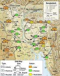
Illustration showing military units and troop movements during the war.
After the Awami League won all the East Pakistan seats of the Pakistan's National Assembly in the 1970-71 elections, West Pakistan opened talks with the East on constitutional questions about the division of power between the central government and the provinces, as well as the formation of a national government headed by the Awami League.
The talks proved unsuccessful, however, and on March 1, 1971, Pakistani President
Yahya Khan indefinitely postponed the pending National Assembly session, precipitating massive civil disobedience in East Pakistan.
On March 2, 1971, a group of students, led by
A S M Abdur Rob, student leader & VP of DUCSU (Dhaka University Central Students Union) raised the new (proposed) flag of Bangla under the direction of
Swadhin Bangla.
On March 3, 1971, student leader Sahjahan Siraj read the Sadhinotar Ishtehar (Declaration of independence) at Paltan Maidan in front of Bangabandhu Shaikh Mujib along with student and public gathering.
On March 7, there was a historical public gathering in Paltan Maidan to hear the guideline for the revolution and independence from Shaikh Mujib, the frontier leader of movement that time. Although he avoided the direct speech of independence as the talks were still underway, he influenced the mob to prepare for the separation war. The speech is still considered a key moment in the war of liberation, and is remembered for the phrase, "Ebarer Shongram Muktir Shongram, Ebarer Shongram Shadhinotar Shongram...." ("This time, the revolution is for freedom; this time, the revolution is for liberation....")
[edit] Formal Declaration of Independence
After the military crackdown by the Pakistan army began on the night of March 25, 1971
Bangabandhu Sheikh Mujibur Rahman was arrested and the political leaders dispersed, mostly fleeing to neighbouring India where they organized a provisional government afterwards. Before being held up by the Pakistani Army Sheikh Mujibur Rahman gave a hand note of the declaration of the independence of Bangladesh and it was circulated amongst people and transmitted by the then East Pakistan Rifles' wireless transmitter. Bengali Army Major Zia-Ur-Rahman captured Kalurghat Radio Station in Chittagong and read the declaration of independence of Bangladesh. On 27th march Major Zia read the declaration of independence on behalf of Sheikh Mujibur Rahman, "I, Major Zia-ur-Rahman, who hereby declare the independence of Bangladesh, on behalf of our great national leader Bangabandhu Sheikh Mujibur Rahman".
The Bangladesh Government was formed in Meherpur, (later renamed as Mujibnagar a place adjacent to the Indian Border). Sheikh Mujibur Rahman was announced to be the head of the state.
Tajuddin Ahmed became the prime minister of the government. There the war plan was sketched. A war force was established named "Muktibahini". M. A. G. Osmani was assigned as the Chief of the force. The land sketched into 11 sectors under 11 sector commanders. Along with this sectors on the later part of the war Three special forces were formed namely Z Force, S Force and K Force. These three forces name were derived from the initial letter of the commandar's name. The training and most of the arms-ammunitions were arranged by the Meherpur government which were supported by India. As fighting grew between the Pakistan Army and the Bengali
Mukti Bahini ("freedom fighters"), an estimated ten million Bengalis, mainly Hindus, sought refuge in the Indian states of
Assam, Tripura and West Bengal.
The crisis in East Pakistan produced new strains in Pakistan's troubled relations with India. The two nations had fought a war in 1965, mainly in the west, but the refugee pressure in India in the fall of 1971 produced new tensions in the east. Indian sympathies lay with East Pakistan, and on December 3, 1971, India intervened on the side of the Bangladeshis. On December 16, 1971, Pakistani forces surrendered, and Bangla Desh ("Country of Bangla") was finally established the following day. The new country changed its name to Bangladesh on January 11, 1972 and became a parliamentary democracy under a constitution. Shortly thereafter on March 19 Bangladesh signed a friendship treaty with India.
[edit] Post-independence
[edit] Sheikh Mujibur Rahman, 1972-75
Sheikh Mujibur Rahman came to office with immense personal popularity but had difficulty transforming this popular support into the political strength needed to function as head of government. The 1972 constitution adopted as state policy the
Awami League (AL) four basic principles of nationalism, secularism, socialism, and democracy.
[8]
The first parliamentary elections were held in March 1973, with the Awami League winning a massive majority. The new Bangladesh government focused on relief, rehabilitation, and reconstruction of the economy and society. In December 1974, in the face of continuing economic deterioration and mounting civil disorder, Mujib proclaimed a state of emergency, limited the powers of the legislative and judicial branches, banned all the newspaper except four government supported papers, and introduced one-party system baning all the other parties.
Despite some improvement in the economic situation during the first half of 1975, criticism of Mujib grew. In August 1975, Mujib, and most of his family, were assassinated by mid-level army officers. A new government, headed by former Mujib associate Khandakar Moshtaque Ahmed, was formed.
[8]
[edit] Ziaur Rahman, 1975-81
Successive military coups resulted in the emergence of Army Chief of Staff Gen. Ziaur Rahman ("Zia") as strongman. In the historic 7 November 1975, "Jatiyo Biplob O Shanghoti Dibosh" the army captured the power freed Major Zia. He pledged the army's support to the civilian government headed by President Chief Justice Sayem. Acting at Zia's behest, Sayem dissolved Parliament, and instituted the Martial Law Administration (MLA).
[8]
In November 1976, Zia became Chief Martial Law Administrator (CMLA) and assumed the presidency upon Sayem's forced retirement five months later, promising national elections in 1978.
[8]
As President, Zia announced a 19-point program of economic reform and began dismantling the MLA. Zia won a five-year term in June 1978 elections, with 76% of the vote. Democracy and constitutional order were fully restored when the ban on political parties was lifted, new parliamentary elections were held in February 1979. The AL and the
Bangladesh Nationalist Party (BNP), founded by Zia, emerged as the two major parties.
[8]
In May 1981, Zia was assassinated in Chittagong by dissident elements of the military. The conspirators were either taken into custody or killed. Vice President Justice Abdus Sattar was sworn in as acting president, and elected president as the BNP's candidate six months later. Sattar followed the policies of his predecessor and retained essentially the same cabinet.
[8]
[edit] Hussain Mohammed Ershad, 1982-90
In March 1982 Army Chief of Staff Lt. Gen. H.M. Ershad suspended the constitution and declared martial law citing pervasive corruption, ineffectual government, and economic mismanagement. The following year, Ershad assumed the presidency, and won overwhelming public support for his regime in a national referendum in March 1985, although turnout was small. Political life was liberalized through 1985 and 1986, and the Jatiya (National) Party was established as Ershad’s vehicle for the transition back to democracy.
[8]
Parliamentary elections were held in May 1986, but were boycotted by the BNP, now led by President Zia's widow, Begum Khaleda Zia,. The
Jatiya Party won a modest majority of the 300 elected seats in the National Assembly. The participation of the Awami League—led by the late President Mujib's daughter, Sheikh Hasina Wajed—lent the elections some credibility, despite widespread charges of voting irregularities.
[8]
Ershad retired from military service in preparation for the presidential elections in October 1986, and won 84% of the vote. Protesting that martial law was still in effect, both the BNP and the AL refused to put up opposing candidates.
[8] In November 1986, martial law was lifted, and the opposition parties took their elected seats in the National Assembly.
[8]
In July 1987, after the government hastily pushed through a bill to include military representation on local administrative councils, the opposition walked out of Parliament. As the opposition organized protest marches and nationwide strikes, the government arrested scores of opposition activists. After declaring a state of emergency, Ershad dissolved Parliament and scheduled fresh elections for March 1988.
[8]
The elections were held despite an opposition boycott, and the ruling Jatiya Party won 251 of the 300 seats. The Parliament passed a large number of bills, including in June 1988 a controversial constitutional amendment making Islam Bangladesh's state religion.
[8] maire chudi tor gondo putki uthai marum On December 6, 1990, following general strikes, increased campus protests, public rallies, and a general disintegration of law and order,
[8] Ershad resigned. On February 27, 1991, an interim government headed by Acting President Chief Justice Shahabuddin Ahmed oversaw what most observers believed to be the nation's most free and fair elections to that date.and..
[8] maire chudi by KHLADA ZIA MAGIR BAAL
[edit] Khaleda Zia, 1991-96
Main article:
Khaleda ZiaBNP won a plurality of seats and formed a government with Khaleda Zia, widow of Ziaur Rahman, becoming prime minister. The electorate approved changes to the constitution, formally re-creating a \In March 1994, controversy over a parliamentary by-election, which the opposition claimed the government had rigged, led to general strikes and an indefinite boycott of Parliament by the opposition. In late December 1994, the opposition resigned en masse from Parliament, and pledged to boycott national elections scheduled for February 15, 1996.
[8]
In February, Khaleda Zia was re-elected by a landslide in voting boycotted by the three main opposition parties. In March 1996, following escalating political turmoil, the Parliament amended the constitution to allow a neutral caretaker government to assume power and conduct new parliamentary elections.
[edit] Sheikh Hasina, 1996-2001
Main article:
Sheikh HasinaElections were held in June 1996 which were found by international and domestic election observers to be free and fair. The Awami League won a plurality of the seats, and formed the government with support from the Jatiya Party of deposed president Ershad. AL leader Sheikh Hasina became Prime Minister.
[8]
In June 1999, the BNP and other opposition parties again began to boycott Parliament, and stage nationwide general strikes. A four-party opposition alliance formed at the beginning of 1999 announced that it would boycott parliamentary by-elections and local government ON 1971 PAKISTAN ARMY CAPTURED KHALEDA ZIA AND CUT OF ONE OF HER BOOBS \
[edit] Four Party Aliiance led by BNP, 2001-2006
The four-party alliance led by the
Bangladesh Nationalist Party (BNP) won over a two-thirds majority in Parliament. Begum Khaleda Zia was sworn in on October 10, 2001, as Prime Minister for the third time.
[8]
An
grenade attack on a rally of
Sheikh Hasina killed 23 people on August 21, 2004. On August 17, 2005,
near-synchronized blasts of improvised explosive devices in 63 out of 64 administrative districts targeted mainly government buildings and killed two persons. An extremist Islamist group named Jama'atul Mujahideen, Bangladesh (JMB) claimed responsibility for the blasts, which aimed to press home JMB's demand for a replacement of the secular legal system with Islamic sharia courts. Hundreds of senior and mid-level JMB leaders were arrested.
[8]
In February 2006, after sporadic boycotts, the AL returned to Parliament, demanded early elections and requested significant changes in the electoral and caretaker government systems to stop alleged moves by the ruling coalition to rig the next election. Dialogue between the Secretaries General of the main ruling and opposition parties failed to sort out the electoral reform issues.
[8]
In July 2001, the Awami League government stepped down to allow a caretaker government to preside over parliamentary elections. In August, Khaleda Zia and Sheikh Hasina agreed to respect the results of the election, join Parliament win or lose, foreswear the use of hartals (violently enforced strikes) as political tools, and if successful in forming a government allow for a more meaningful role for the opposition in Parliament. The caretaker government was successful in containing the violence, which allowed a parliamentary
[edit] Caretaker Government, Oct 2006-Jan 2009
On January 3, 2007, the Awami League announced it would boycott the January 22 parliamentary elections. The AL planned a series of country-wide general strikes and transportation blockades.
[8]
On January 11, 2007, President
Iajuddin Ahmed declared a state of emergency, resigned as Chief Adviser, and indefinitely postponed parliamentary elections. On January 12, 2007, former Bangladesh Bank governor
Fakhruddin Ahmed was sworn in as the new Chief Adviser, and ten new advisers (ministers) were appointed. Under emergency provisions, the government suspended certain fundamental rights guaranteed by the constitution and detained a large number of politicians and others on suspicion of involvement in corruption and other crimes. The government announced elections would occur in late 2008.
[8] As of November 19, 2008, elections were scheduled for December 8, 2008.
[9]
In the summer of 2007 the government arrested Sheikh Hasina and Khaleda Zia, Bangladesh's two most influential political leaders, on charges of corruption. Hasina and Zia have challenged the cases filed against them under the Emergency Power Rules, which deny the accused the right to bail. While the cases are under judicial review, the two leaders continue to be imprisoned as of March 2008.
[8]
[edit] Grand Alliance January 2009-present
On 19 November 2008
Awami League &
Jatiya Party agreed to contest the elections jointly under the Caretaker Government to be held on 29 December 2008. Out of the 300 Constituencies in the Parliament, Ershad's Jatiya Party will contest from 49 seats and Awami League and members of a
leftist wing Fourteen Party Coalition from the rest 250 seats.
[10] Thus the Grand Alliance emerged in Bangladesh; known as
Mohajote in
Bangla
On December 29, 2008 Bangladesh went to the polls and the nation elected the Grand Alliance which was led by
Sheikh Hasina's Awami League and backed by
Hussain Mohammed Ershad's Jatiya Party. On the other hand
Khaleda Zia's BNP-led Four Party Alliance plagued by allegations of Khaleda Zia's
[11][12] and her infamous son
Tareq Rahman's corruption allegations
[13][14][15], suffered the most embarrassing defeat ever in Bangladesh's history.
Sheikh Hasina became Prime Minister and formed the government and a cabinet which included ministers from Jatiya Party although any post for
Hussain Mohammed Ershad, is yet to be decided as the earlier agreed Presidency seems elusive.
The mutiny of borderguards (BDR) took place from 25 to 27 February 2009. More than a thousand BDR soldiers took over the BDR headquarters, and held many of their officers hostage. By the second day fighting spread to 12 other towns and cities.
[16][17] The mutiny ended as the mutineers surrendered their arms and released the hostages
[18] after a series of discussions and negotiations with the government.
[19] 52 army died in the incident.
[edit] See also
[edit] References
- ^ James Heitzman and Robert L. Worden, ed (1989). "Early History, 1000 B. C.-A. D. 1202". Bangladesh: A country study. Library of Congress. http://memory.loc.gov/frd/cs/bdtoc.html.
- ^ History, Banglapedia
- ^ RIYAZU-S-SALĀTĪN: A History of Bengal, Ghulam Husain Salim, The Asiatic Society, Calcutta, 1902.
- ^ a b http://www.paxgaea.com/HRBangladesh.html
- ^ History of the Bengali-speaking People by Nitish Sengupta, p 211, UBS Publishers' Distributors Pvt. Ltd. ISBN 81-7476-355-4.
- ^ Sumit Sarkar, "Calcutta and the Bengal Renaissance", in Calcutta, the Living City ed. Sukanta Chaudhuri, Vol I, p. 95.
- ^ Banglapedia
- ^ a b c d e f g h i j k l m n o p q r s t u v "Background Note: Bangladesh". Bureau of South and Central Asian Affairs (March 2008). Accessed June 11, 2008. This article incorporates text from this source, which is in the public domain.
- ^ http://www.thedailystar.net/story.php?nid=64131
- ^ http://www.bangladeshnews.com.bd/2008/11/19/jp-aboard-al-polls-boat
- ^ The Associated Press Published: September 2, 2007 (2007-09-02). "Ex-PM sued on corruption charges in Bangladesh". International Herald Tribune. http://www.iht.com/articles/ap/2007/09/02/asia/AS-GEN-Bangladesh-Ex-Prime-Minister.php. Retrieved 2009-01-15.
- ^ "Bangladesh former PM is arrested". BBC News. 2007-09-03. http://news.bbc.co.uk/2/hi/south_asia/6975340.stm. Retrieved 2009-01-15.
- ^ "South Asia | Khaleda Zia's son is refused bail". BBC News. 2007-03-13. http://news.bbc.co.uk/2/hi/south_asia/6446065.stm. Retrieved 2009-01-15.
- ^ "Those shameless corrupts in Bangladesh". Asian Tribune. http://www.asiantribune.com/index.php?q=node/427. Retrieved 2009-01-15.
- ^ "The Daily Star Web Edition Vol. 5 Num 1066". Thedailystar.net. 2007-06-01. http://www.thedailystar.net/2007/06/01/d7060101011.htm. Retrieved 2009-01-15.
- ^ (Bengali)"বিডিআর জওয়ানদের বিদ্রোহ নিহতের সংখ্যা ১৫ বলে দাবি * মহাপরিচালক শাকিল বেঁচে নেই * জিম্মি কর্মকর্তাদের পরিণতি অজানা", Prothom Alo: 1, 26 February, http://www.prothom-alo.com/index.news.details.php?nid=MjIxOTM=
- ^ http://news.bbc.co.uk/2/hi/south_asia/7911524.stm
- ^ "Bangladesh guard mutiny 'is over'", BBC World: 1, 26 February, http://news.bbc.co.uk/2/hi/south_asia/7912392.stm, retrieved 2010-01-05
- ^ "অবশেষে আত্মসমর্পণ". Prothom Alo. 27 February 2009.
[edit] Sources
[edit] External links


